Top Down
A walkable topography of Toronto's urban form
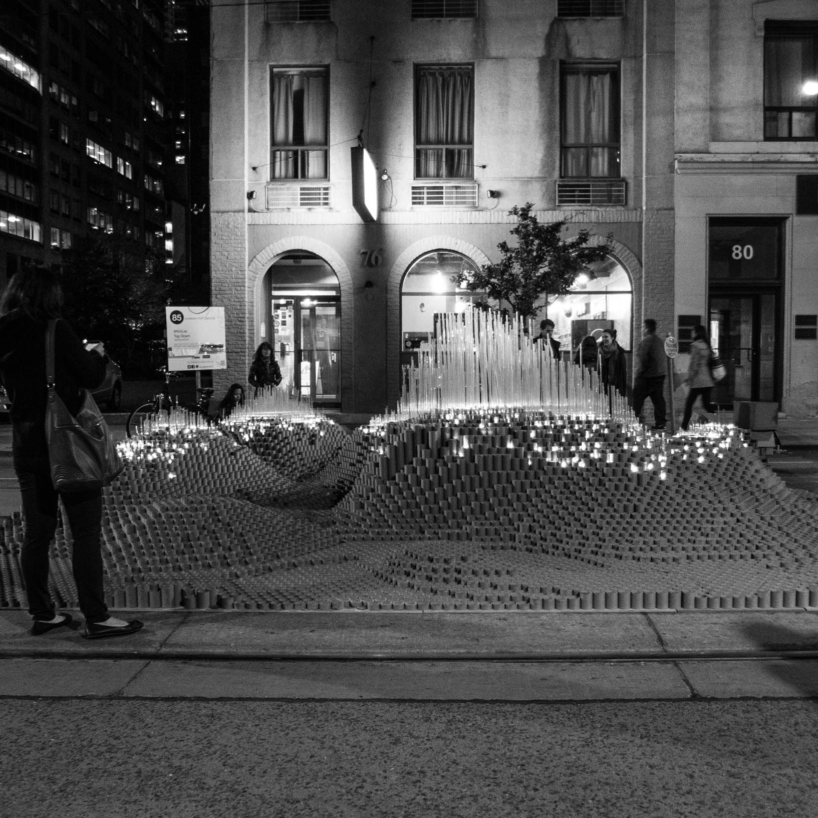
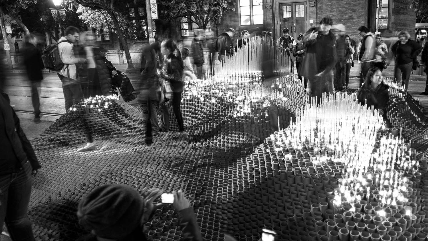
Using Toronto's building height data, this project created an artificial topography of the city and reduced these conditions to a walkable scale. Through its shift in scale, participants developed a new interaction with the familiar city by exploring Toronto's constructed topography.
Role: data sourcing and analysis, digital modeling, fabrication, physical protyping, fundraising
Tools: QGIS, Rhino, Grasshopper, CNC Router
Shown at Nuit Blanche, Toronto, 2012
In collaboration with Taylor Davey, Samantha Eby and Katherine Kovalcik
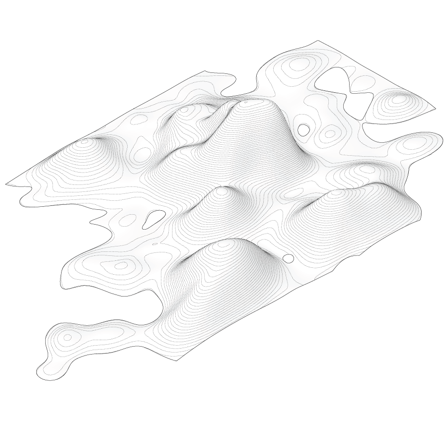
Surface Analysis
Using Toronto's building heights within the downtown core, a topographic surface was generated. The Z-axis of the resultant surface was scaled to intensify the physical experience of walking on and through the installation by exaggerating the peaks and valleys.
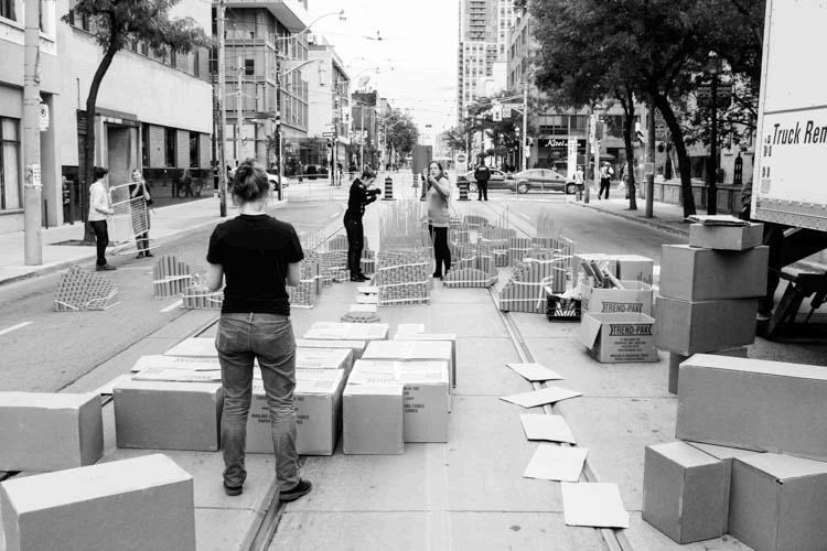
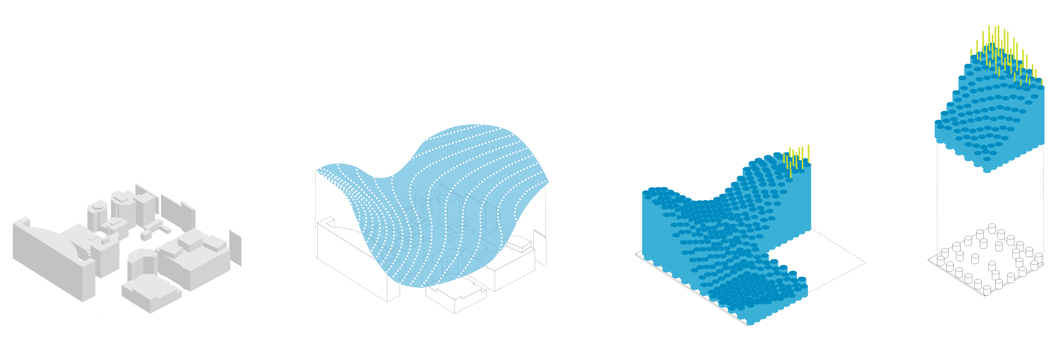
Fabrication
The digital surface was physically manifested with an array of cardboard mailing tubes and acrylic rods. Building heights over 12 storeys were represented by acrylic rods illuminated with LEDs.
For constructability and transportation, the site was divided into 20 individual panels, wach containing 120 tubes. In total, the project used over 16,000 cardboard tubes of 28 different heights and 3000 acrylic rods.